
Drone Real Estate Photography for Architects: Beyond Aerial Marketing
Most content treats drone photography as a marketing upgrade. For architects, that framing is incomplete. Drone real estate photography should function as architectural intelligence. Which supports site analysis, construction monitoring, compliance validation, and measurable business growth.
Problem: Architects frequently trust on ground photography, Google Earth screenshots, or third-party visuals that lack accuracy and ownership.
Agitation: That leads to weaker site analysis, avoidable design conflicts, repetitive site visits, and underwhelming project presentations. In competitive markets, this is a silent disadvantage.
Solution (Direct Answer): Architects should integrate drone photography strategically across the project lifecycle — from feasibility and zoning context studies to construction monitoring and final marketing — either through a structured in-house program or a compliant outsourcing model.
This guide explains exactly how to do that.
Why Drone Photography Matters Specifically for Architects
Most top-ranking articles focus on real estate agents. Architects have different priorities.
Site Context and Urban Fabric Analysis
Before sketching massing concepts, architects need:
- Adjacency understanding
- Shadow impact patterns
- Access roads and pedestrian movement
- Roofscape context
- Utility corridors and constraints
Ground photos flatten context. Satellite imagery is often outdated.
Drone imagery gives current, project-specific aerial data from controlled altitudes and angles.
Practical Example:
A mid-rise residential project in a dense Indian metro may require sunlight compliance analysis. Drone-captured imagery allows you to visually validate surrounding building heights and potential obstruction zones before formal simulation modeling.
This complements — not replaces — tools like Autodesk Revit, BIM 360, or GIS mapping.
Design Presentation & Client Acquisition
Developers and institutional clients think in risk and return.
Aerial visuals communicate:
- Project scale relative to surroundings
- Landmark proximity
- Connectivity strength
- Visual dominance or harmony
According to findings often referenced by the National Association of Realtors (NAR), listings with aerial imagery tend to generate higher engagement. For architects, this translates to stronger developer pitch decks and competition submissions.
Drone visuals shift perception from “design proposal” to “context-aware investment asset.”
Property Value Perception & Developer ROI
Real estate marketing research consistently shows that perceived spatial context influences buyer psychology.
Aerial visuals emphasize:
- Plot size
- Green buffer
- Road width
- Amenity proximity
Architects who supply drone-ready visual documentation strengthen their value proposition to developers.
This is strategic positioning, not just photography.
The Architectural Lifecycle Framework for Drone Integration
Drone value compounds when integrated across phases.
Phase 1 – Pre-Design & Feasibility
Objectives:
- Context documentation
- Access analysis
- Environmental review
Outputs:
- High-resolution orthographic captures
- Oblique perspective context shots
- Early volumetric overlays
Drone data supports feasibility studies before heavy modeling begins.
Phase 2 – Construction Monitoring
This is where operational ROI becomes visible.
Benefits include:
- Reduced physical site visits
- Safer inspection of high elevations
- Stakeholder reporting visuals
- Timeline validation
McKinsey’s reports on construction productivity highlight digital monitoring as a key efficiency lever. Drone documentation aligns directly with that principle.
Illustrative Scenario:
Instead of three senior architects traveling monthly to inspect facade alignment, one certified drone operator captures standardized footage for review.
Time savings compound over multi-year projects.
Phase 3 – Marketing & Portfolio Development
Post-completion drone imagery becomes:
- Portfolio documentation
- Award submission material
- Website hero visuals
- Developer sales assets
This creates long-term branding leverage.
In-House Drone Program vs Outsourcing
The right choice depends on scale and regulatory environment.
Cost Comparison Overview
| Factor | In-House Drone Program | Outsourced Drone Service |
| Initial Investment | Drone + camera + accessories | None |
| Licensing & Registration | Required (DGCA/FAA etc.) | Handled by vendor |
| Insurance | Must arrange | Typically included |
| Ongoing Maintenance | Your responsibility | Vendor responsibility |
| Scalability | High if frequent projects | Flexible but cost per project |
| Control & Data Ownership | Full | Contract-dependent |
Skill Requirements
In-house capability requires:
- Certified pilot (e.g., DGCA Remote Pilot Certificate in India)
- Airspace compliance understanding
- Image post-processing expertise
- Data storage workflow
For firms doing fewer than 6–8 aerial projects per year, outsourcing is often economically rational.
Decision Framework
Ask:
- How many projects require aerial documentation annually?
- Are most sites in controlled or restricted airspace?
- Do you need repeat monthly documentation?
- Is branding control critical?
Small boutique firms: Start outsourced.
Large multi-city firms: Build structured internal capability.
Legal & Compliance Considerations (India + Global Snapshot)
Drone use is regulated aviation activity.
India (DGCA)
Under the Digital Sky Platform framework:
- Drones must be registered.
- Operators need certification (except nano category in limited use).
- No-fly zones are enforced digitally (NPNT system).
Refer to India’s Directorate General of Civil Aviation (DGCA) for current guidelines.
United States (FAA)
Under FAA Part 107:
- Remote Pilot Certificate required.
- Operational limits apply (altitude, visual line of sight).
Europe (EASA)
EASA classifies operations by risk category (Open, Specific, Certified).
Architects working across borders must verify project-specific rules.
Important: This article is not legal advice. Always confirm current regulations before operations.
Drone Photography vs Traditional Real Estate Photography
| Criteria | Drone Photography | Ground Photography |
| Context Visibility | High | Limited |
| Cost per Shoot | Moderate–High | Low–Moderate |
| Regulatory Burden | Significant | Minimal |
| Risk Exposure | Higher | Lower |
| Best Use Case | Site context, scale, marketing | Interior, detail, facade |
Best practice: Use both. Hybrid visual storytelling performs strongest.
ROI Modeling for Architects
ROI is not hypothetical. It comes from:
Marketing ROI
- Higher proposal differentiation
- Stronger developer pitch decks
- Portfolio authority
Operational ROI
- Fewer senior staff site visits
- Faster issue detection
- Improved stakeholder transparency
Sample ROI Framework (Illustrative)
| Component | Annual Estimate |
| Drone Investment (Equipment + Licensing) | Moderate upfront |
| Site Visit Reduction | 15–30% reduction possible (illustrative) |
| Proposal Conversion Lift | Qualitative improvement |
| Construction Delay Avoidance | Project-dependent |
Even modest reductions in rework or travel can offset equipment cost within 1–2 major projects.
Visual Trend: Growth of Drone Adoption in Real Estate (Illustrative Index)
Below is a conceptual adoption trend graph (index-based, illustrative only).
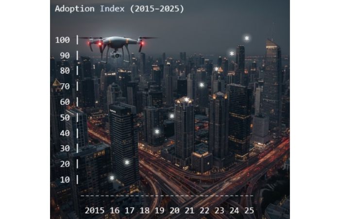
Trend insight: Adoption accelerates as regulations stabilize and camera quality improves.
Technical Best Practices for Architects
Focus on:
- Minimum 20MP sensor
- RAW image capture
- Consistent altitude benchmarks for comparability
- Structured file naming per project phase
- Cloud-backed storage
Integrate imagery into:
- BIM overlays
- GIS layers
- Progress reports
Avoid cinematic-only footage if analytical documentation is your goal.
Common Mistakes Architects Make
- Treating drones purely as marketing tools
- Ignoring regulatory exposure
- Flying without insurance
- Capturing random angles without structured flight plan
- No long-term data storage strategy
Drone programs fail due to poor process, not poor hardware.
Future Trends
-
- AI-assisted aerial mapping
- Automated progress comparison via computer vision
- 3D reconstruction from drone photogrammetry
- Integration with digital twins
Organizations like the World Economic Forum frequently highlight digital construction ecosystems. Drone integration is part of that shift.
Who This Guide Is For (And Not For)
For:
- Architecture firms evaluating drone integration
- Developers partnering with architects
- Design teams seeking operational efficiency
Not For:
- Hobbyist drone pilots
- Purely cinematic video creators
- Firms unwilling to engage compliance requirements
Conclusion
Drone real estate photography is not an accessory. It is emerging infrastructure for modern architectural practice.
Used strategically, it enhances design intelligence, improves compliance awareness, reduces operational inefficiencies, and strengthens market positioning.
Architects who treat drones as workflow assets — not marketing gimmicks — gain structural advantage in competitive real estate environments. The opportunity is not in flying higher. It is in integrating smarter.